LAB-Net: Lidar and aerial image-based building segmentation using U-Nets
DOI:
https://doi.org/10.5617/nmi.10163Keywords:
remote sensing, aerial image, lidar, Image segmentationAbstract
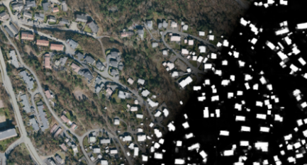
We describe our approach in the 2022 NORA MapAI competition. The objective of the competition was to construct methods that were able to detect and segment buildings from aerial imaging and laser data. There were two subtasks: (1) building segmentation from aerial imaging; (2) building segmentation from lidar data, optionally combined with aerial images. We trained multiple dynamic U-Net models with self-attention layers. For Task 1, we used a ResNet34-based encoder pre-trained on the ImageNet challenge dataset and further pre-trained the U-Net on another similar aerial image dataset. For Task 2, we adapted the dynamic U-Net to deal with multispectral data. Our ensembles placed us in second place, with the top score on Task 1. The complete source code for reproducing our results is available at https://github.com/HVL-ML/LAB-Net.
Downloads
Published
Issue
Section
License
Copyright (c) 2022 Nordic Machine Intelligence

This work is licensed under a Creative Commons Attribution 4.0 International License.


